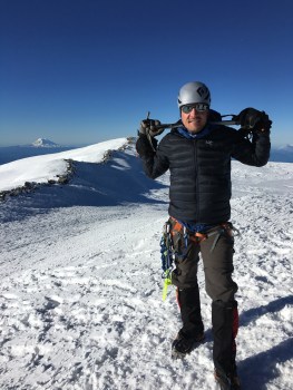
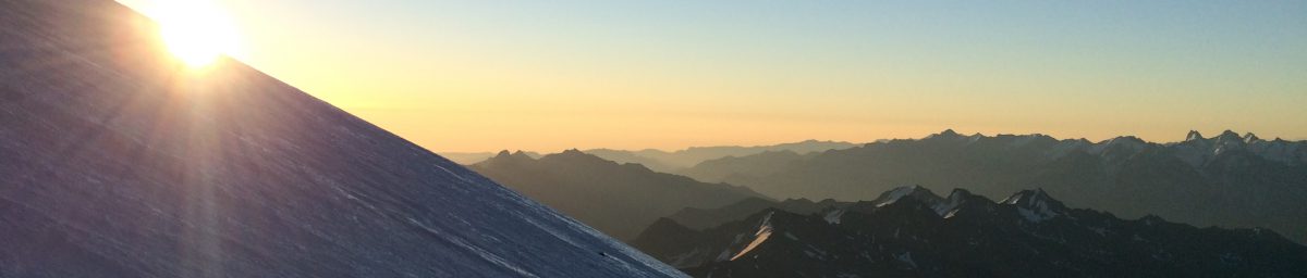
After my last post, a few folks correctly pointed out that some imagery and a more detailed itinerary would help make sense of the tracking map. Thanks for the feedback and here ya go:
We will fly onto the glacier at 7,200′ and, with about 125 pounds split between a pack and a sled, will start with a downhill ski to around 6,800′ before turning the corner and heading up to the base of “Ski Hill.” Those ~5.5 miles will put us at about 7,800′ after day one. The next day will see us getting up to 9,500′ and then up to about 11,000′ on the third day. From there, we will likely do a carry to the 14,000′ camp where we will cache about 70 pounds of gear and food before skiing/boarding back to the 11,000′ foot camp for another night. The next day will be a move to 14,000′ with the rest of our gear. This carry-then-move strategy helps break up the weight on a larger vertical move and gives us another night to acclimate.
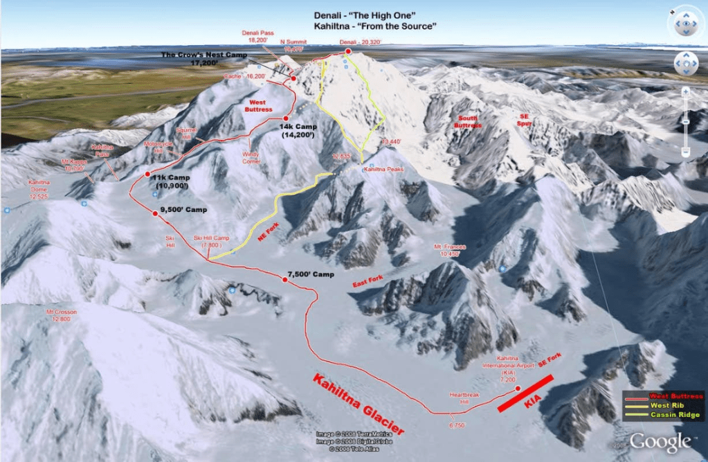
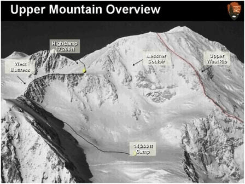
From there, we will spend a day recovering at 14,000′ before a recon day near the base of the Messner Couloir. This will get us over 15,000′ and allow us to scout conditions for a potential ski/board descent down one of the most iconic lines in North America. The movement also gets our bodies adjusting to the decreasing partial pressure of oxygen. At 16,000′, there is only about 50% of the oxygen that you get at sea level. Following this outing, we will have another rest day at the 14,000′ camp where we will be sorting and packing gear for our summit shot when the weather allows.
The next 24-36 hour weather window will be our first chance at a summit bid. This is where our route will diverge from the standard Western Buttress Route. Likely starting around midnight, we will take the cutoff to the Upper West Rib and follow a more technical route that ascends more directly to the summit. This route can be good snowy conditions that allow “easy” steps to be kicked in, icy conditions that require ice screws and snow pickets for running protection, or rocky conditions that will see us scrambling up with “stopper” protection placed in constrictions in said rock. We will be attempting to go straight to the summit from 14,000′. This will allow us to travel lighter and faster than we would if we were planning for a high camp but will make for a very long day up to the summit at 20,300′.
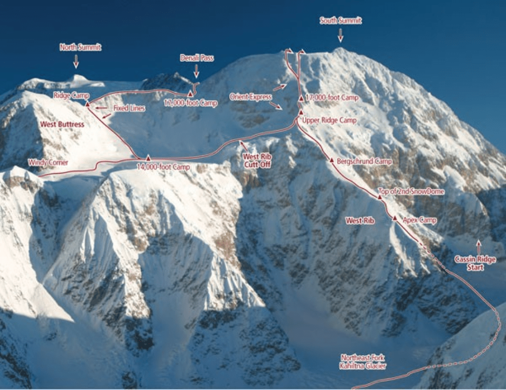
If we are lucky with conditions, strength, and timing, we then get to look down at what some people call the best ski/board descent of their lives. The Messner Couloir is a gorgeous, 4,000′ narrowing chute that dumps out just above the 14,000′ camp as seen below. It gets fairly steep (up to 50 degrees) and can be dicey if the conditions aren’t ideal. This is why our recon day is so important and why we will only take this route if we feel it can be done safely. If we are lucky, we will get to “send” this line and save hours off our descent. If the mountain determines otherwise, we will be descending the Western Buttress while we stare longingly over at the Messner.
Back at 14,000′, we will get some much needed sleep and rest. The next day we will get up early, break camp, and get ready for another fun day. This is where we will be the envy of the mountain as we quickly ski/board all the way down to the base of Heartbreak Hill at 6,800′. From there is a quick one mile skin up to the airfield. It shouldn’t take more than two hours by ski whereas those on foot might spend an entire day covering the same ground. It also spreads our weight out over a larger area which decreases the chances of falling through a snow bridge. Once we are back at the airfield we will load up on the next plane and be on our way to our first shower and real meal in 2-3 weeks.
Of course, weather is a huge part of any Denali climb. From even getting onto the glacier, to being stuck in white out blizzards at every camp, we could be forced into a waiting situation at any point for days on end. Those days aren’t quite as fun or scenic, but we’ve got a good team and a cook tent where we can all gather in a circle playing cards and talking.
Ok, that’s about all the details you’ll need to know to follow the bouncing dot on the “Tracking Map” page. Cheers to all and next update from Alaska as we get ready to fly onto the glacier.
